


Wisconsin
Create a 3D relief map of your state! These topographical terrain maps make the perfect decor for residents, travelers, and explorers of the state.
Subscribe to keep an eye on the new models each week! Check the subscription tiers for personal and commercial use of the 3D prints, and our custom model development service!
Steps:
- Import the STL to your slicer.
- Scale the X or Y dimension to the desired size with 'Uniform scale' checked.
- (Optional) Scale up the Z dimension to accentuate the 3D features.
- Use default slicer settings for your printer with the smallest layer height it can do. For maximum detail, use 0.10 - 0.16 mm layer height. You can use a larger layer height to draw attention to the topographical lines that are naturally created with the layer stair-stepping.
- Slice and print.
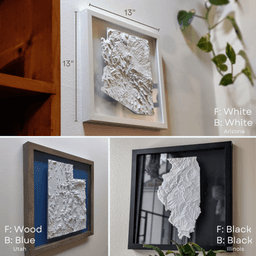
- Mount in a frame or shadow box. Add paper behind the model/glass to add an accent color with shadowing. Or try a floating frame. Or don't frame it, and mount it directly on the wall with mounting strips. Make it your own style!
- Set on shelf, tabletop, or hang on wall with sticky mounting strips.
About the models: These are the most detailed and accurate 3D-printable cityscape and landscape models available. Each is designed and optimized from Micropolitan's 5+ years of experience developing and selling 3D prints of iconic locations worldwide. Each model is designed by hand, using a combination of data and reference imagery. We use LiDAR and refine the architecture, block by block, using digital sculpting tools and satellite imagery. The models are then optimized for detail preservation while keeping the file size manageable for personal computers and slicers to handle.
Making your piece: These make perfect centerpieces or collections for your home, to document your travels, or as distinct and unique gifts. Many design options are available - framed and unframed, for wall, tabletop or shelf display. They can be printed in a range of sizes with stunning detail, typically from 6"x6" up to 12"x12"+. The model can be cut into 4+ tiles to print and assemble a piece larger than your build plate.
Size: Scale to at least 150x150mm to preserve details. The bigger the better!
- Layer height: 0.10 - 0.25mm
- Top Layers: 4 - 6
- Nozzle: 0.4 - 0.6mm
- Infill: 15% Gyroid
Styling and display: These look great framed or unframed! They can be displayed on tabletops, shelves, or hung on the wall with mounting strips. They look best when lit from the side. Display near a window, lamp or downlight to make the 3D features pop.
Materials: Filament: For a minimalist look and best grayscale shadowing, use a matte white PLA. Marble and silky filaments are also popular looks. Frames: Choose a frame or shadow box that fits your print dimensions.
This 3D model was developed with reference data sources and satellite imagery from OpenStreetMap OpenStreetMap contributors and USGS 3DEP.
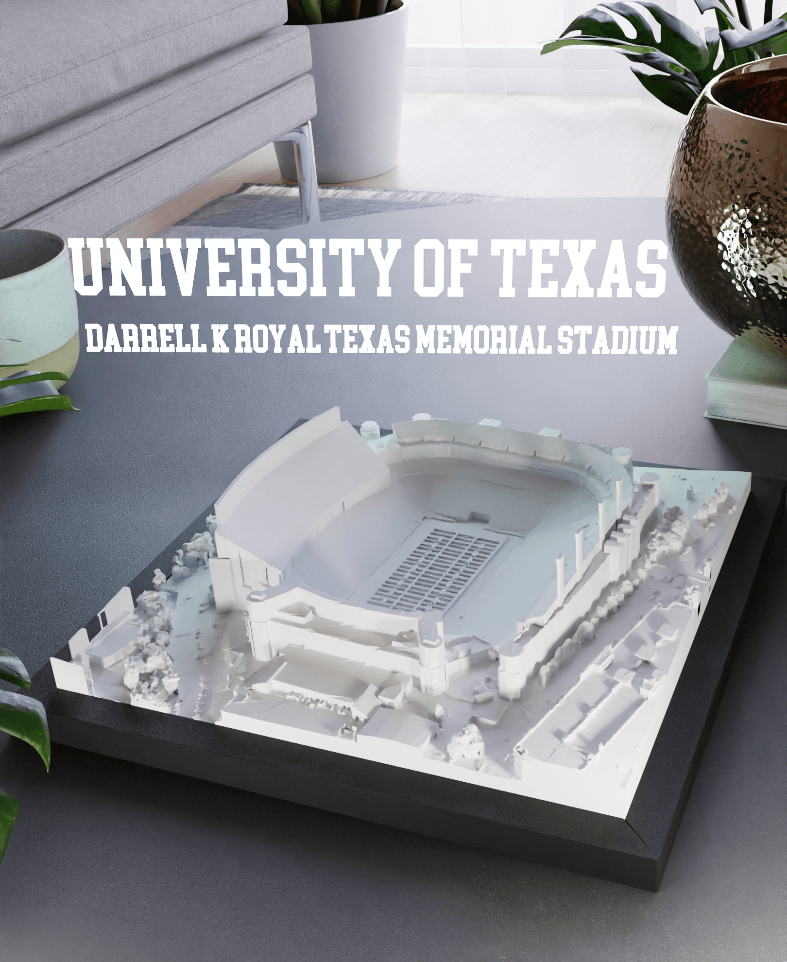
University of Texas - Darrell K Royal–Texas Memorial Stadium
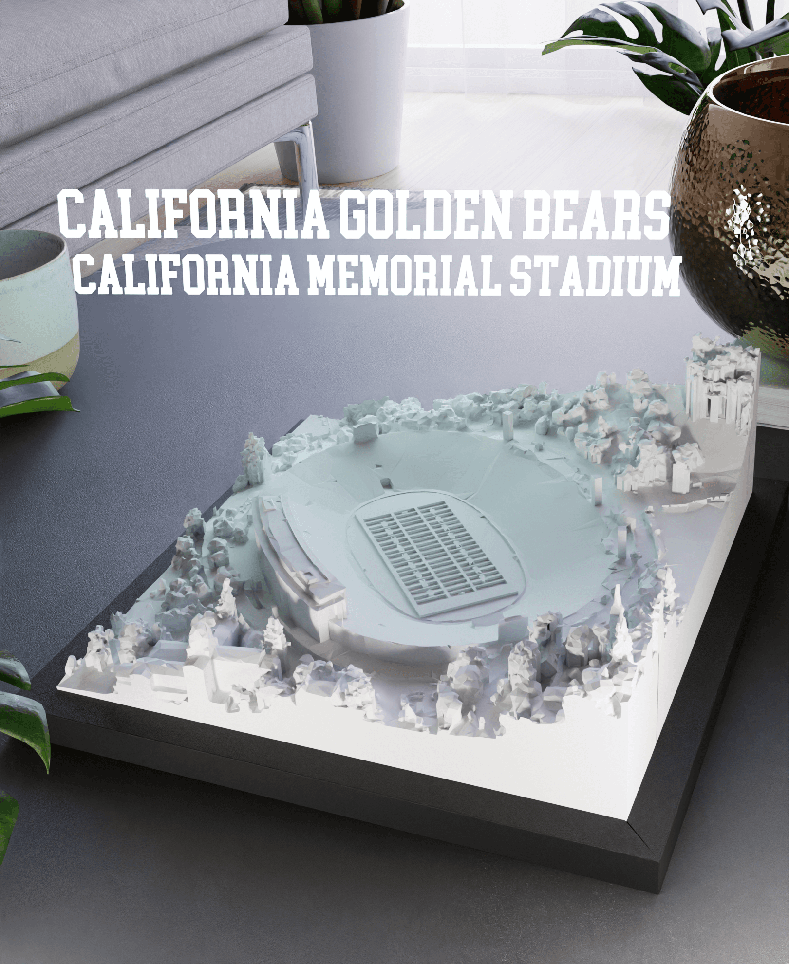
California Golden Bears - California Memorial Stadium
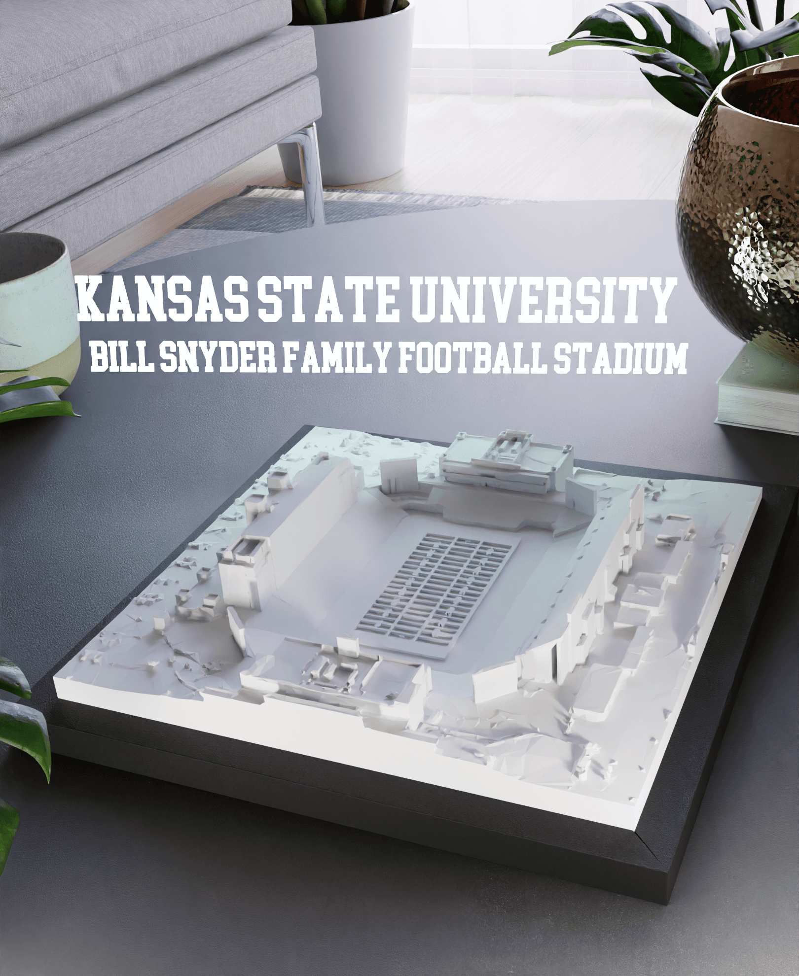
Kansas State University - Bill Snyder Family Football Stadium
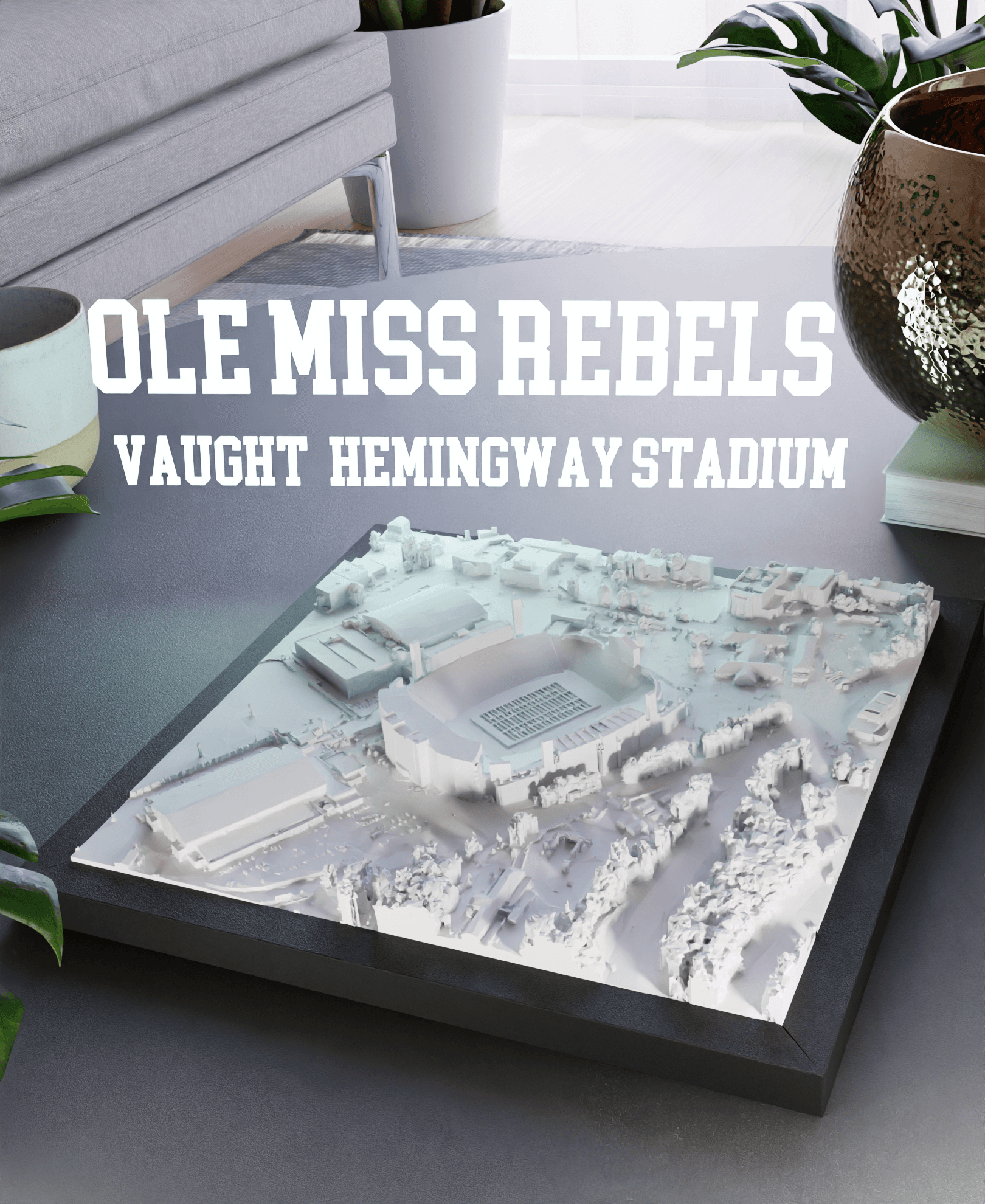
Ole Miss Rebels - Vaught-Hemingway Stadium
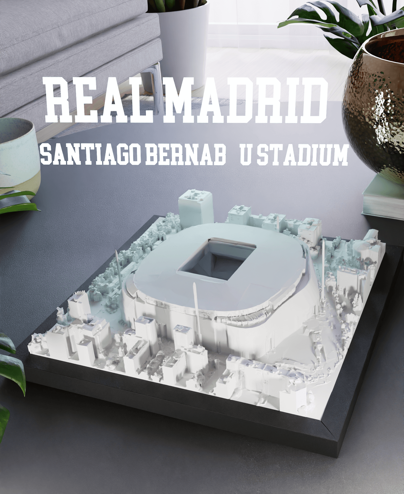
Real Madrid - Santiago Bernabéu Stadium
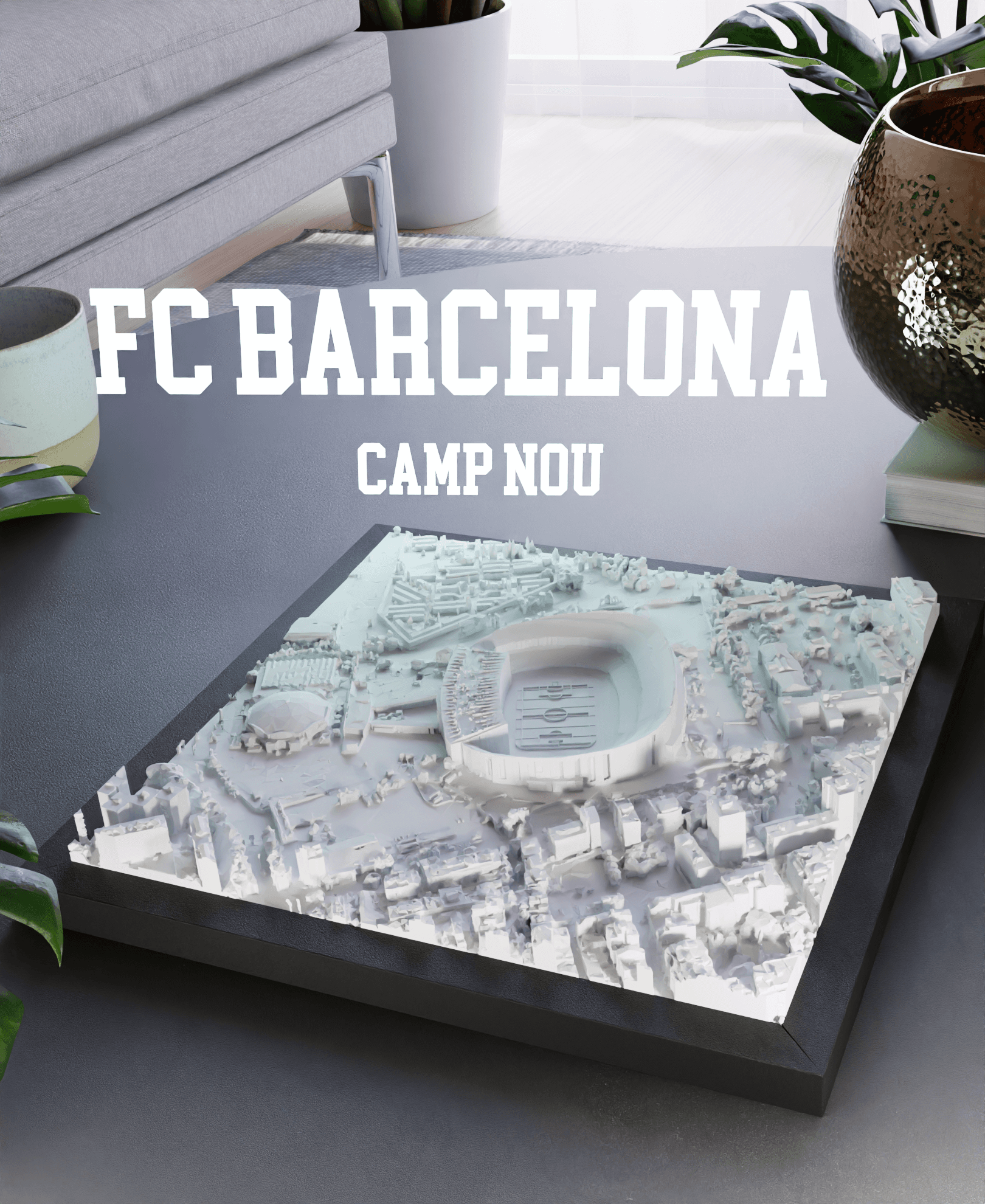
FC Barcelona - Camp Nou
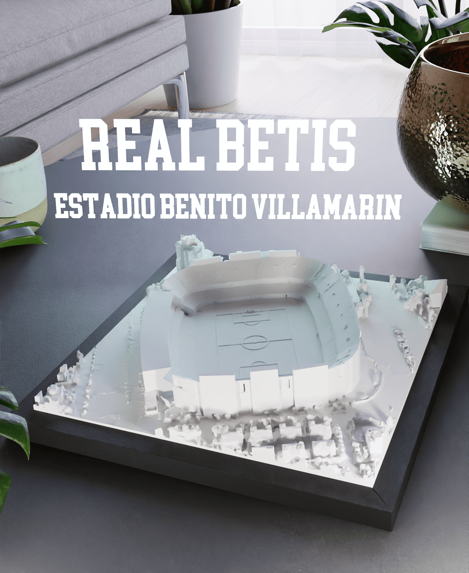
Real Betis - Estadio Benito Villamarin
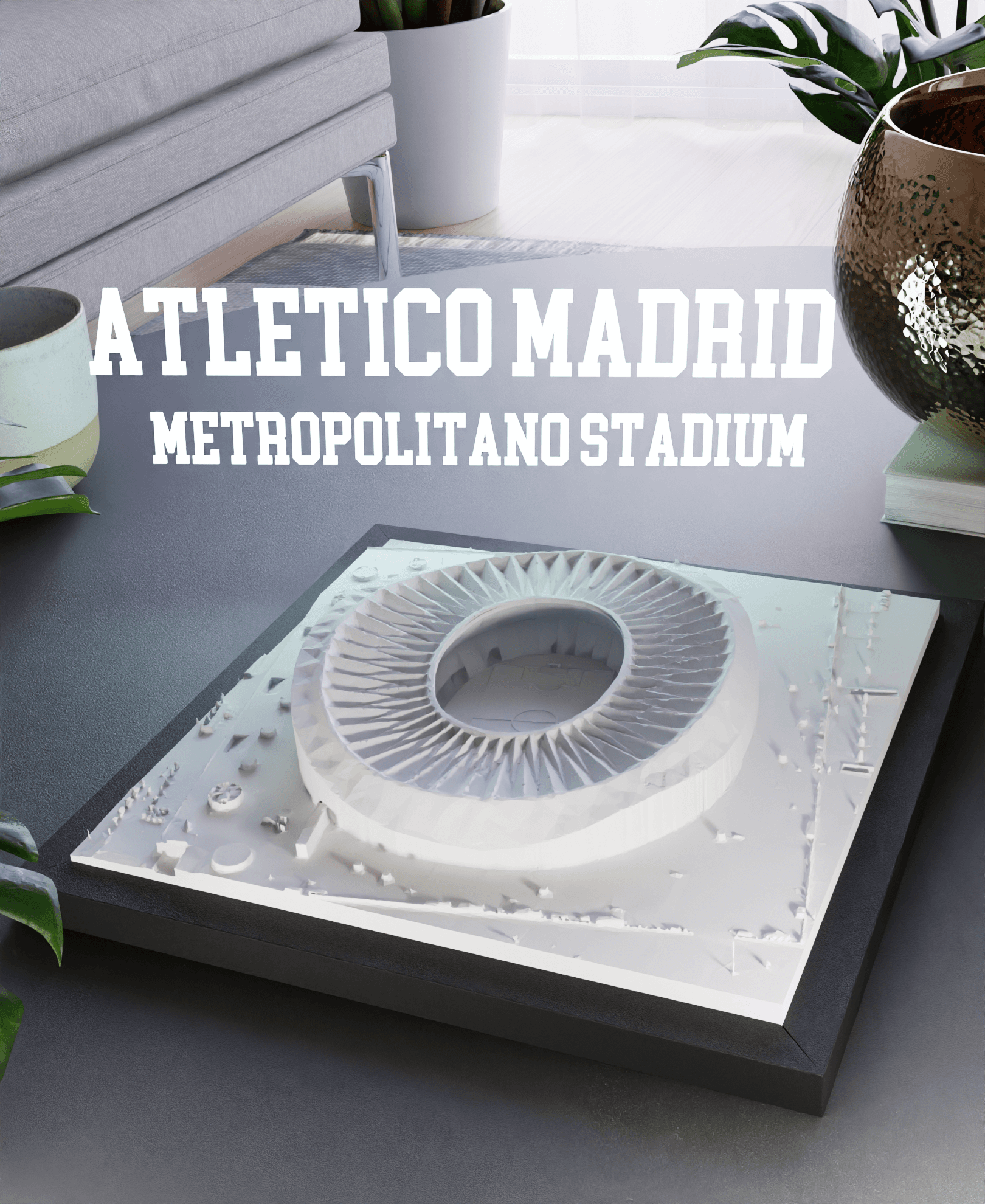
Atletico Madrid - Metropolitano Stadium
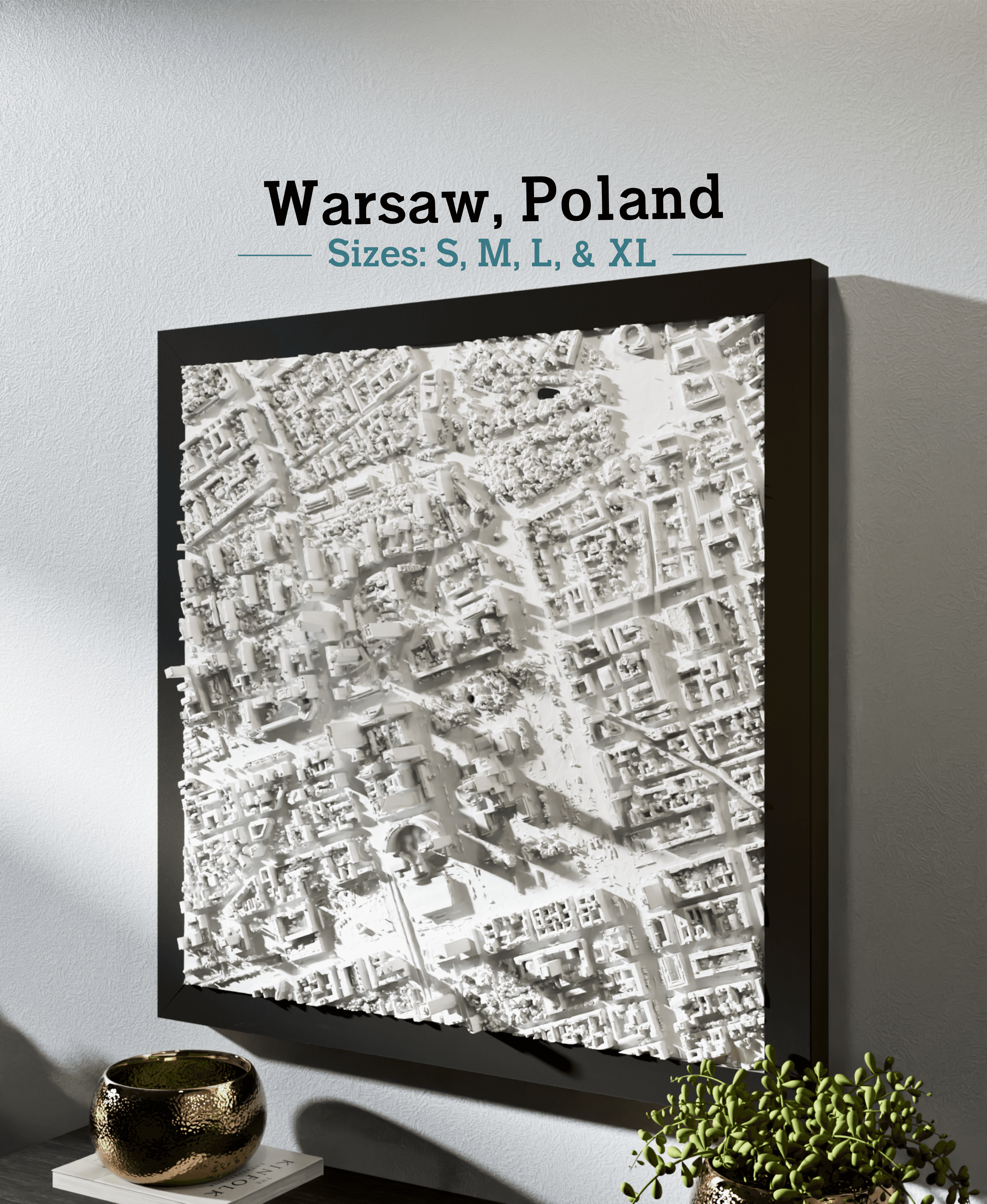
Warsaw, Poland - S, M, L, & XL
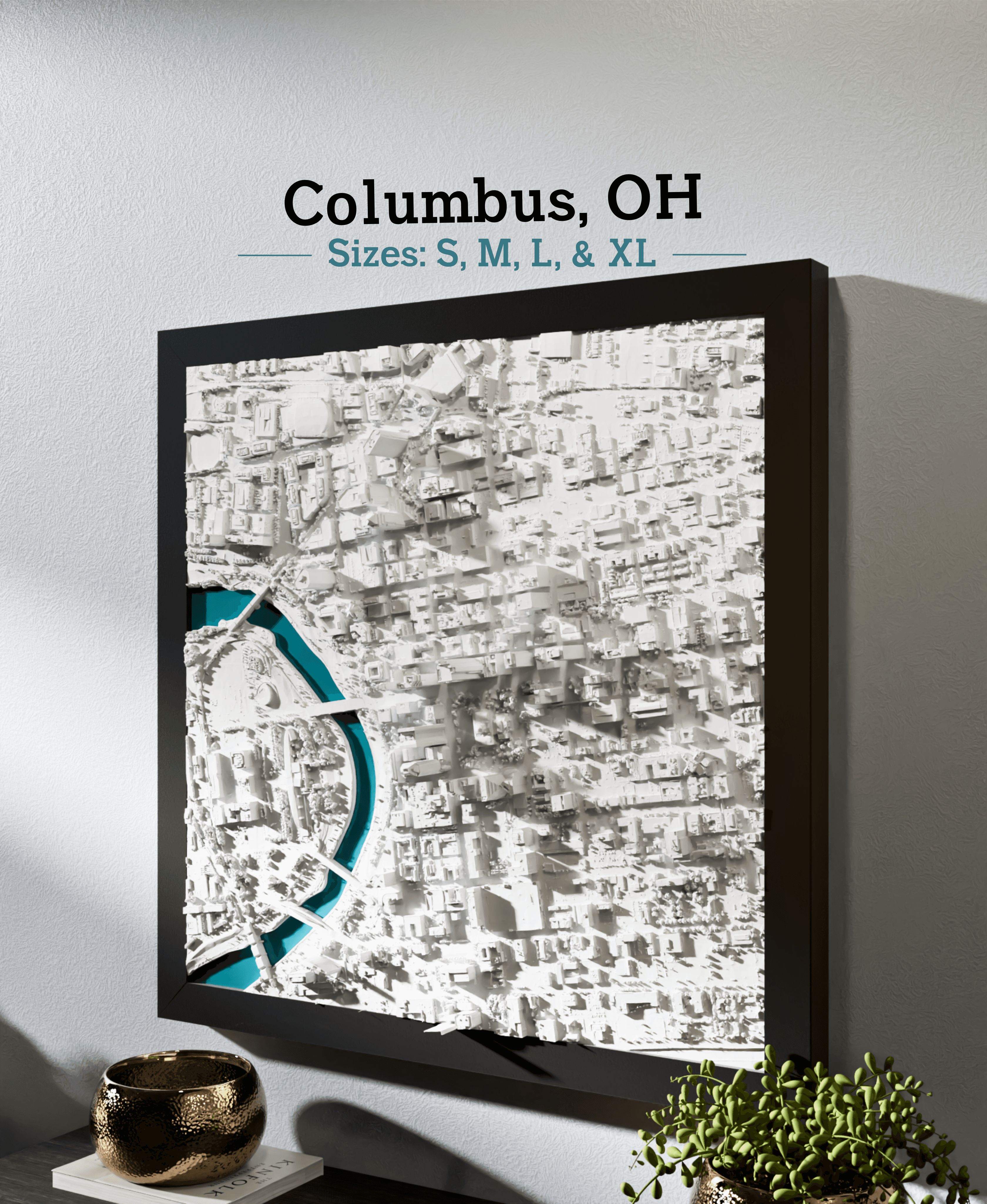
Columbus, OH - S, M, L, & XL
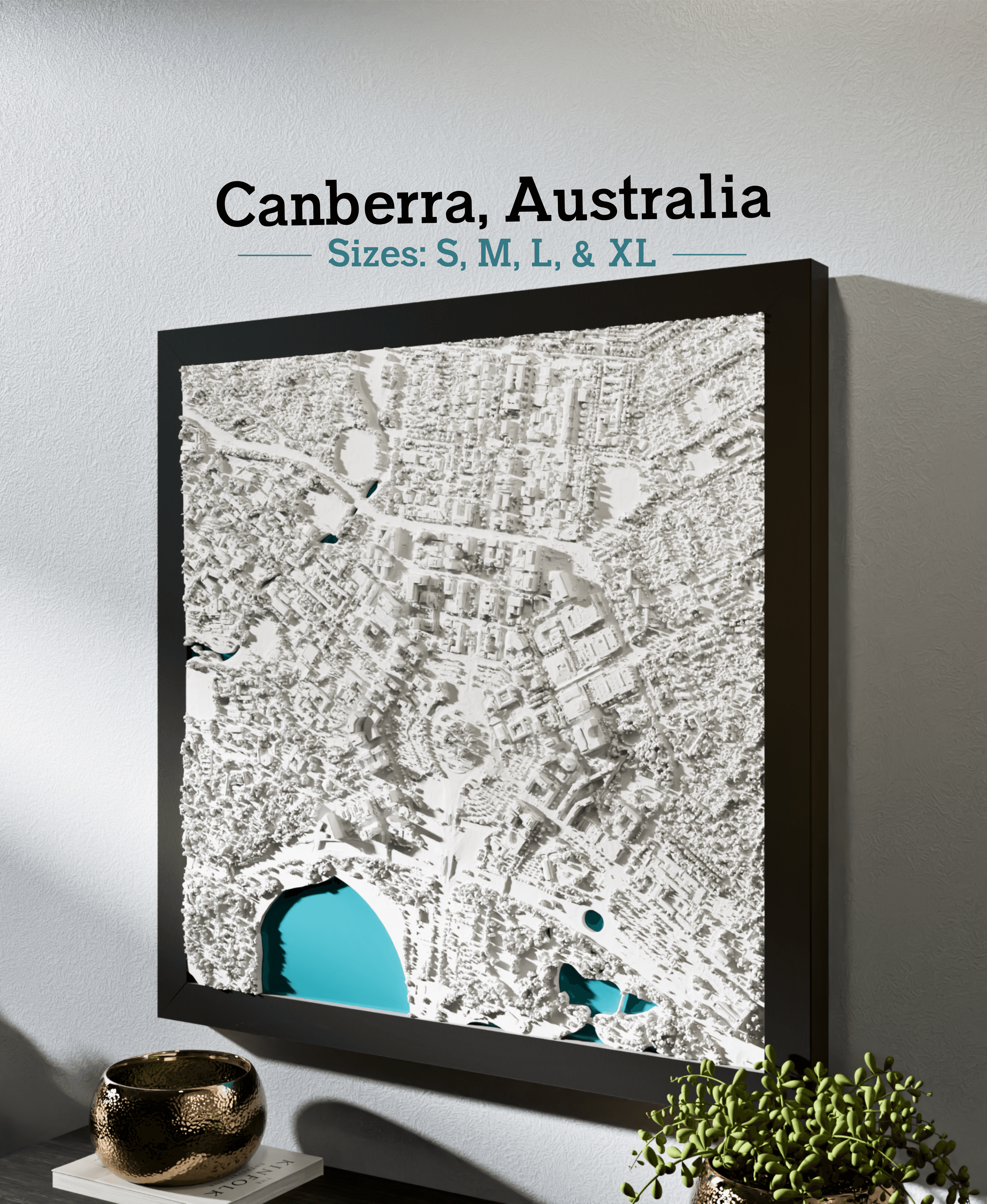
Canberra, Australia - S, M, L, XL
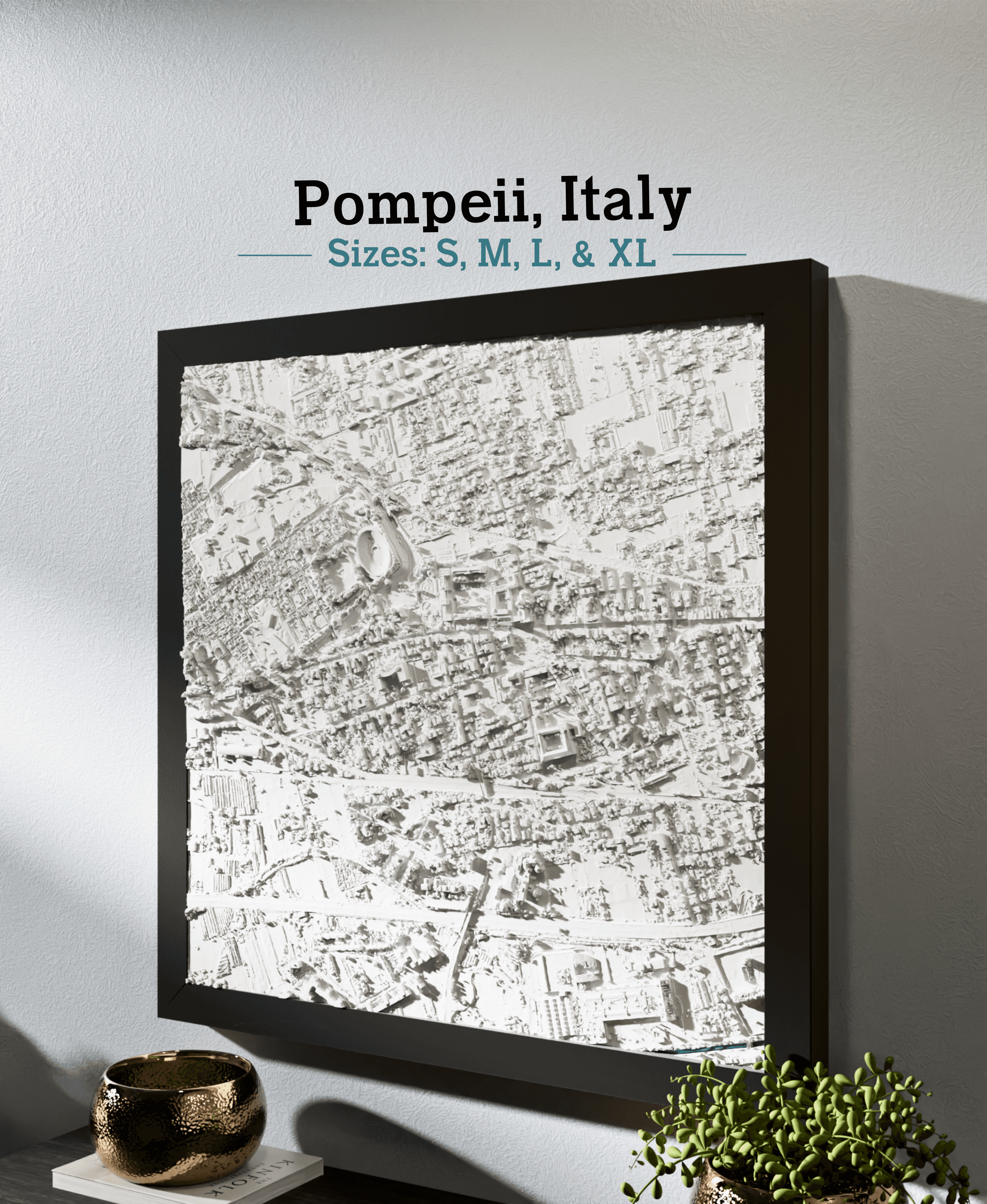
Pompeii, Italy - S, M, L, & XL
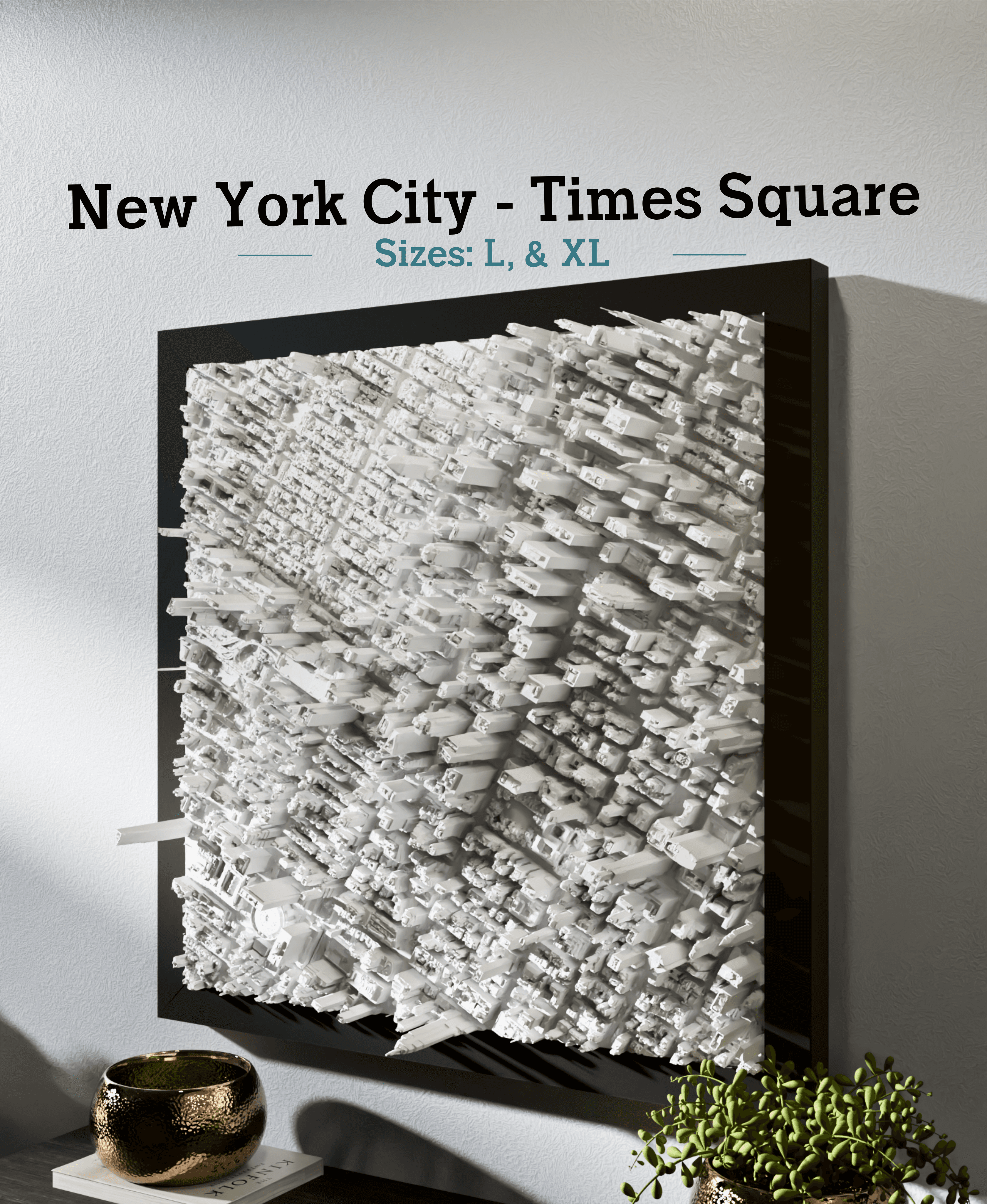
New York City - Times Square - S, M, L, & XL
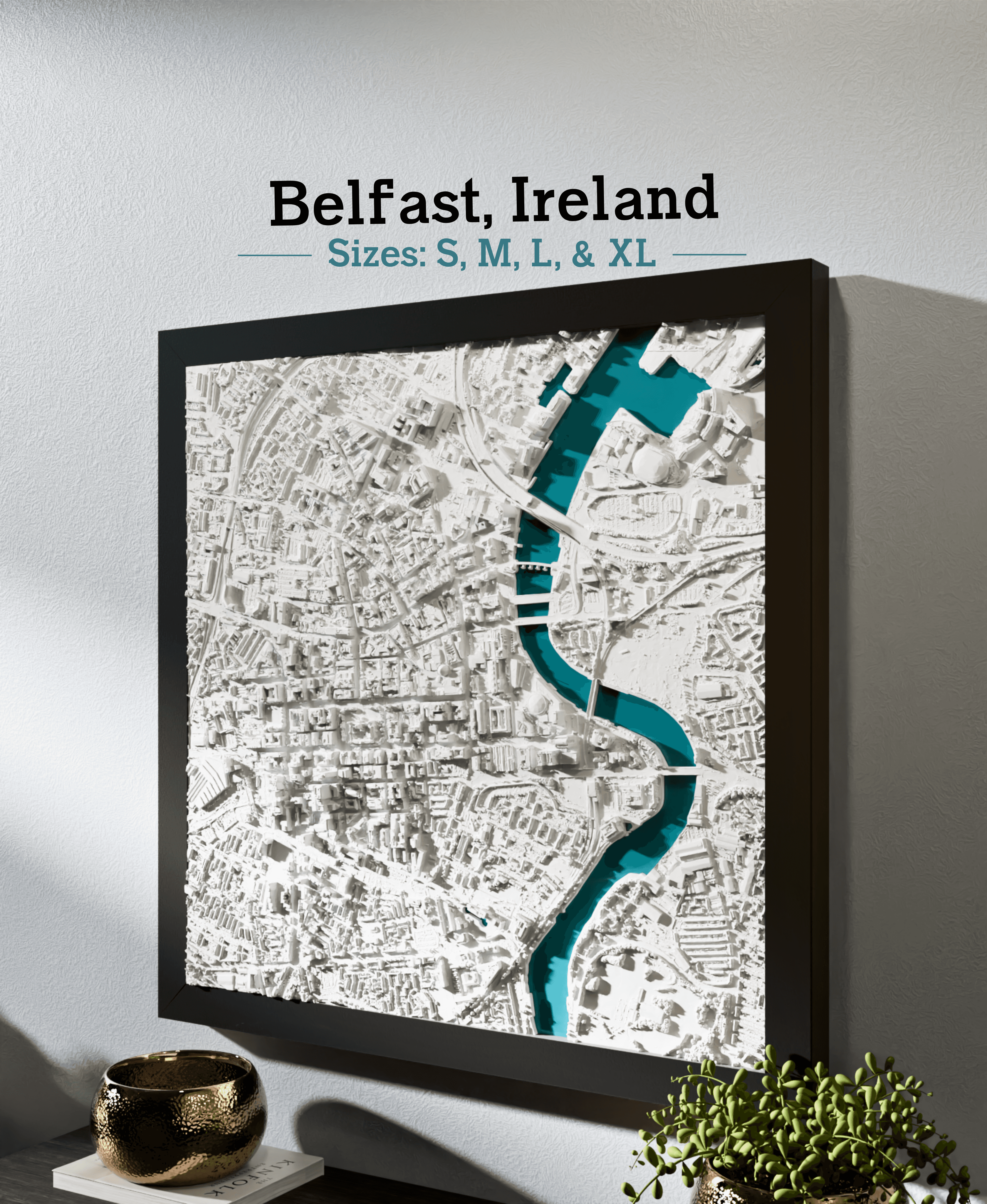
Belfast, Ireland - S, M, L, & XL
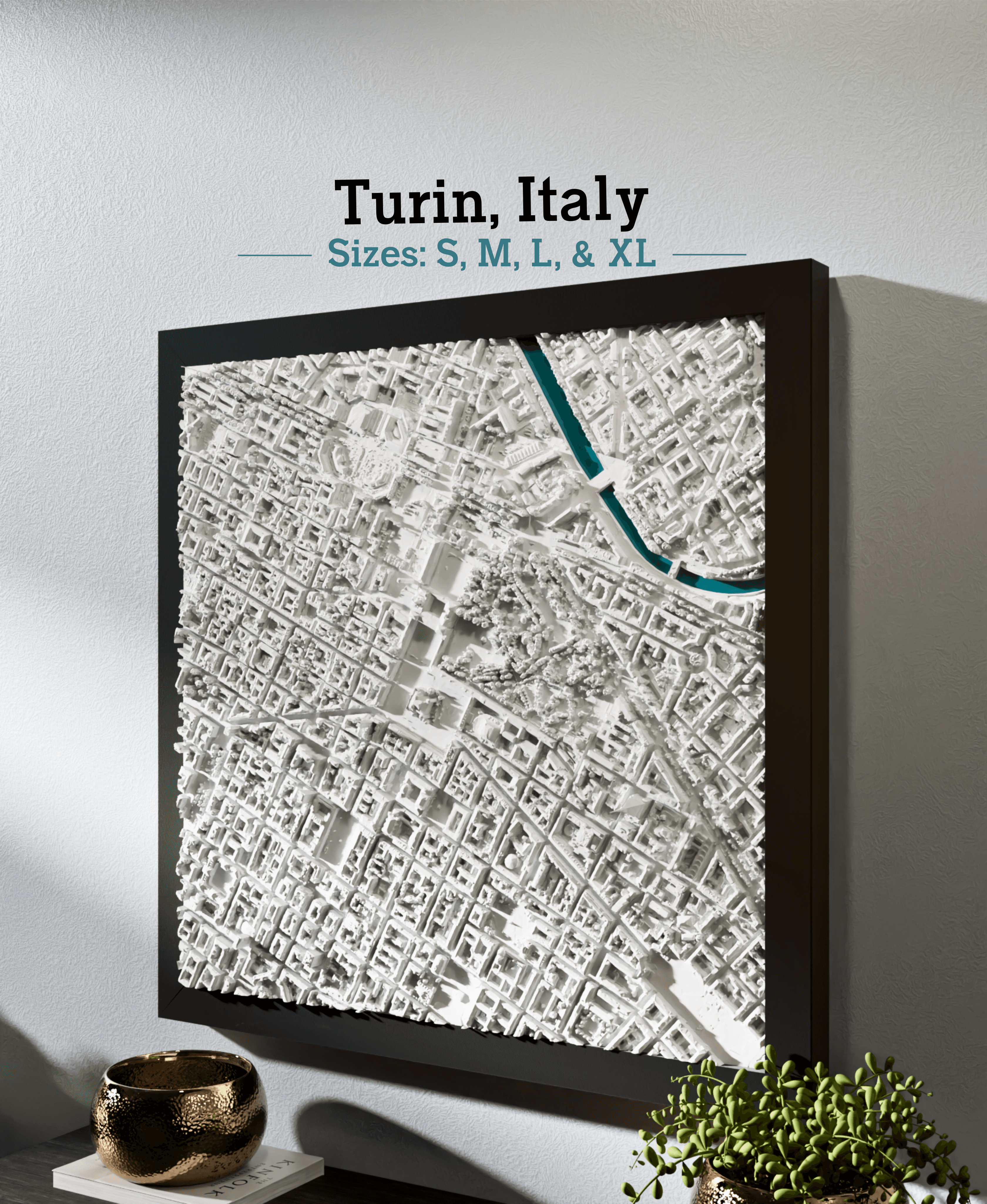
Turin, Italy - S, M, L, & XL

Orlando, FL - S, M, L, & XL
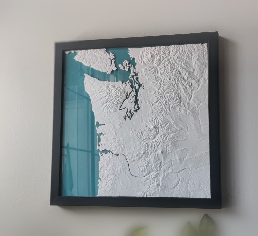
Pacific Northwest
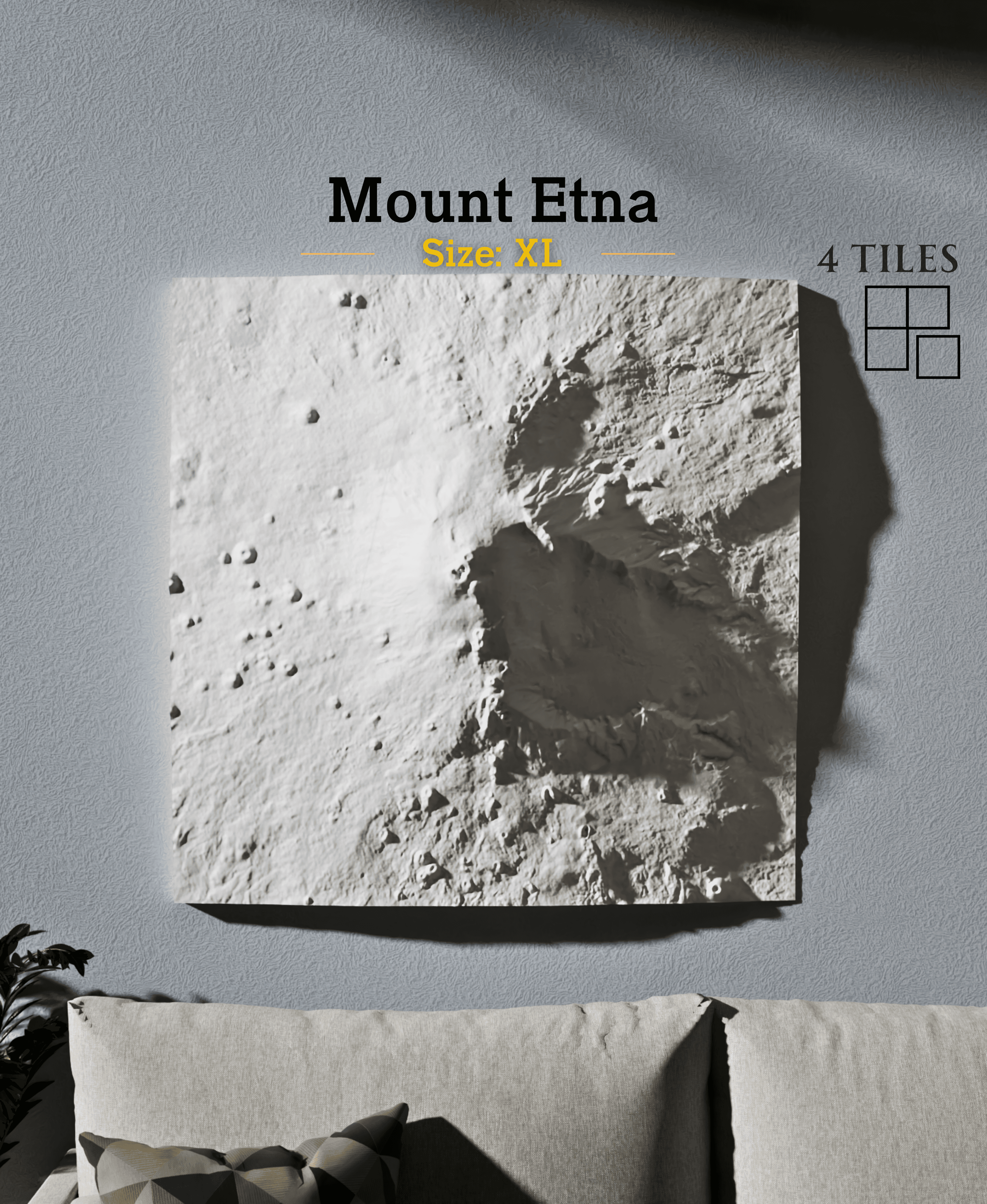
Mount Etna
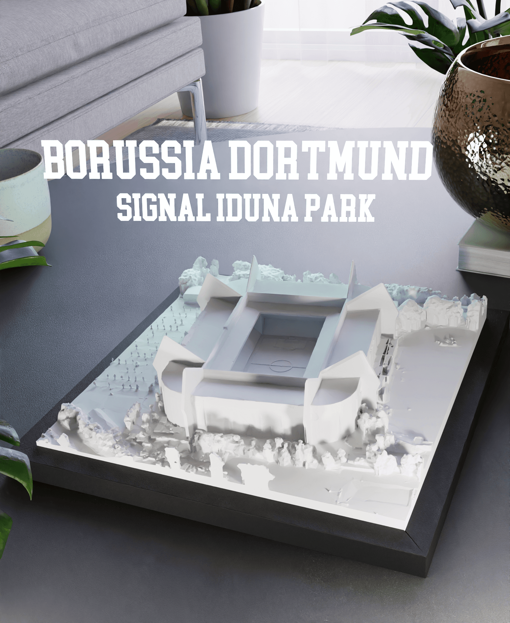
Borussia Dortmund - Signal Iduna Park
