.png&w=256&q=75)
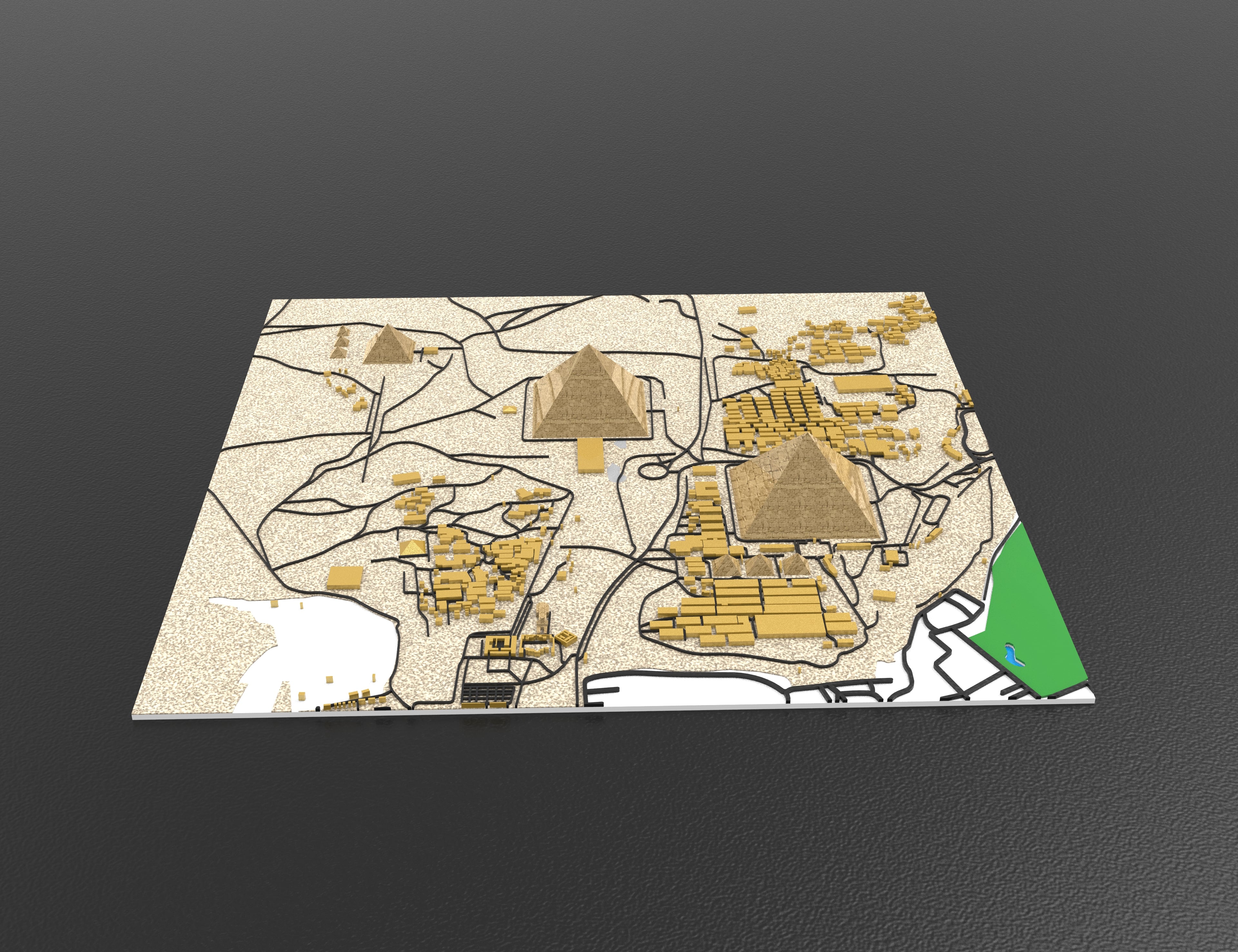
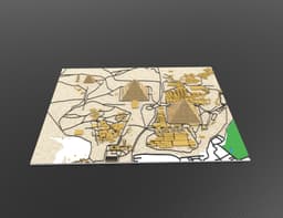
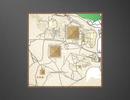
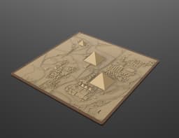
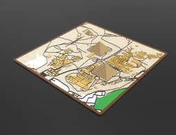
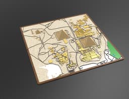
Advertising Giza Pyramids 3D Relief Map – Detailed Topographic Model
0 downloads · 8 months ago · Discover a highly detailed 3D relief map of the Giza Pyramids complex, designed with precision to sh
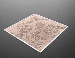
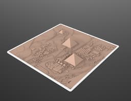
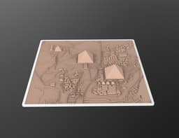
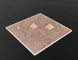
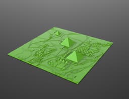
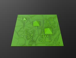
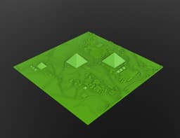
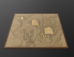
Discover a highly detailed 3D relief map of the Giza Pyramids complex, designed with precision to showcase one of the world’s most iconic archaeological sites. This model features:
The three main pyramids in accurate scale
Roads, pathways, and surrounding urban structures
Clear topographic layout with layered elevations
Clean color-coded areas (green, blue, yellow, white, black)
A wooden-style base frame for a premium display look
This model is perfect for: ✔ 3D printing ✔ Educational displays ✔ Home or office décor ✔ Collectibles for history and architecture lovers
The design is optimized for clean slicing and successful printing on FDM, resin, and SLS printers.
Model includes all necessary files in high-quality formats suitable for most slicers.
Advertising Giza Pyramids 3D Relief Map – Detailed Topographic Model
0 downloads · 8 months ago

Butterfly Blossom Vase
.png&w=3840&q=75)
Bent Pyramid Sneferu Pyramid 3D Model STL, Ancient Egypt Printable Pyramid, Historical Architecture

Ancient Egyptian Obelisks Collection 7 Historical Obelisk Models 3D print model
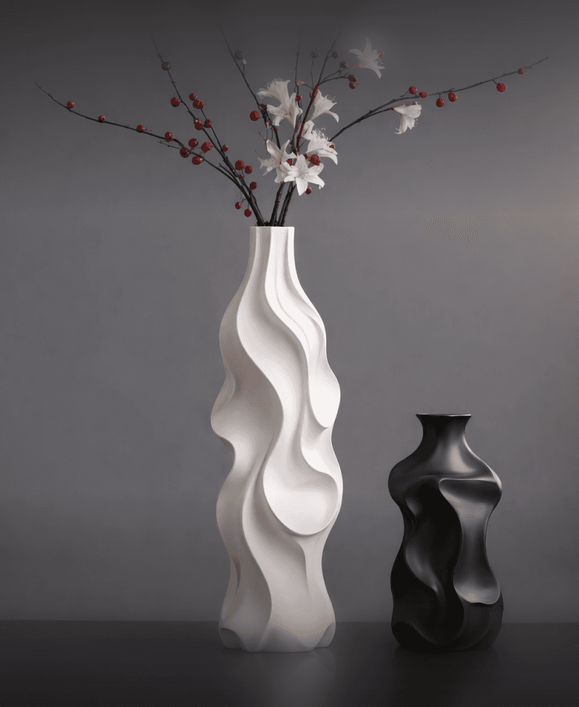
Fluid Wave Sculptural Vase Set – Organic Modern 3D Design
Elegant Ribbon Twist Vase
.png&w=3840&q=75)
Verdant Leaf Vase – Modern Organic 3D Printed Design

Romantic Couple Vase Set – Bride & Groom 3D Printable STL
.png&w=3840&q=75)
Elegant Wedding Couple Vases – Bride & Groom
.png&w=3840&q=75)
Jabal Tuwaiq Mountain, Riyadh, Saudi Arabia | جبل طويق، الرياض، المملكة العربية السعودية
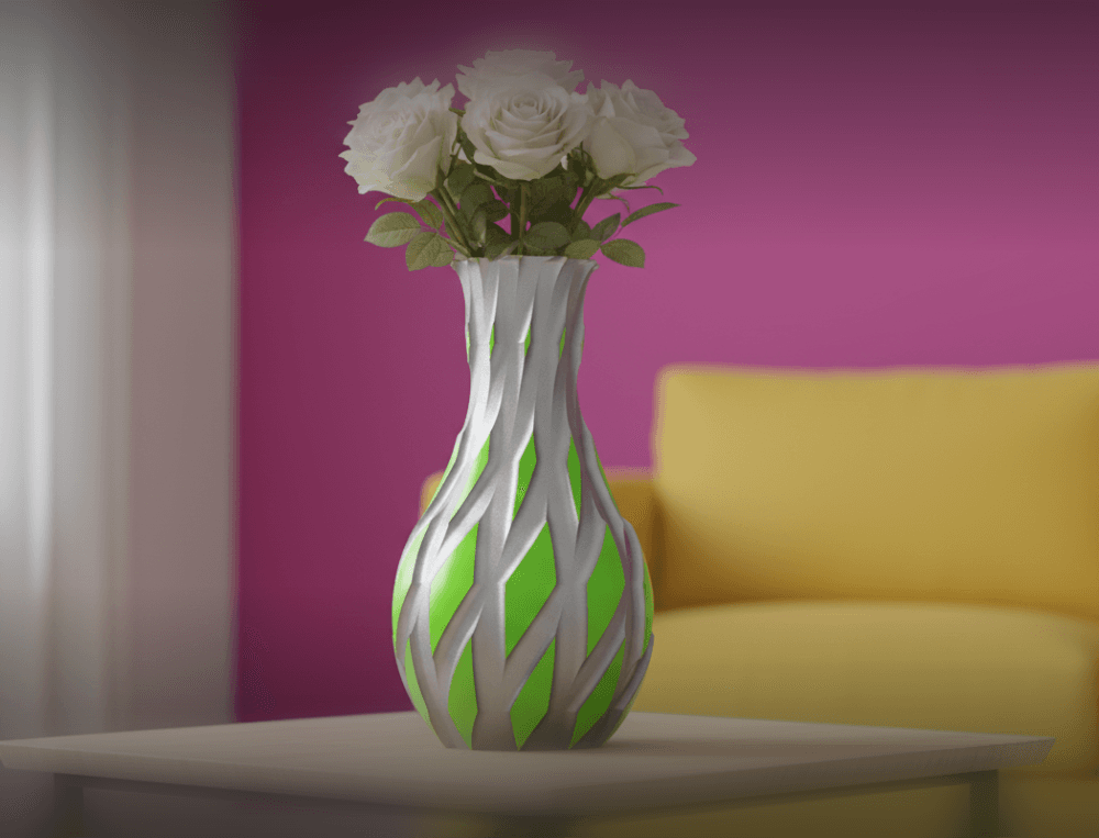
Flow Weave Vase – Organic 3D Printable Design
.jpg&w=3840&q=75)
Azure Accent Vase
.png&w=3840&q=75)
Bloom Relief Vase
.png&w=3840&q=75)
3D design of the iconic Colosseum in Rome
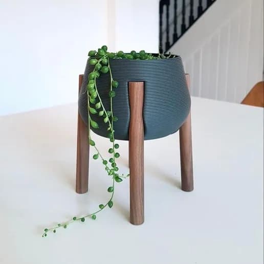
Natural Elegance Pot Stand
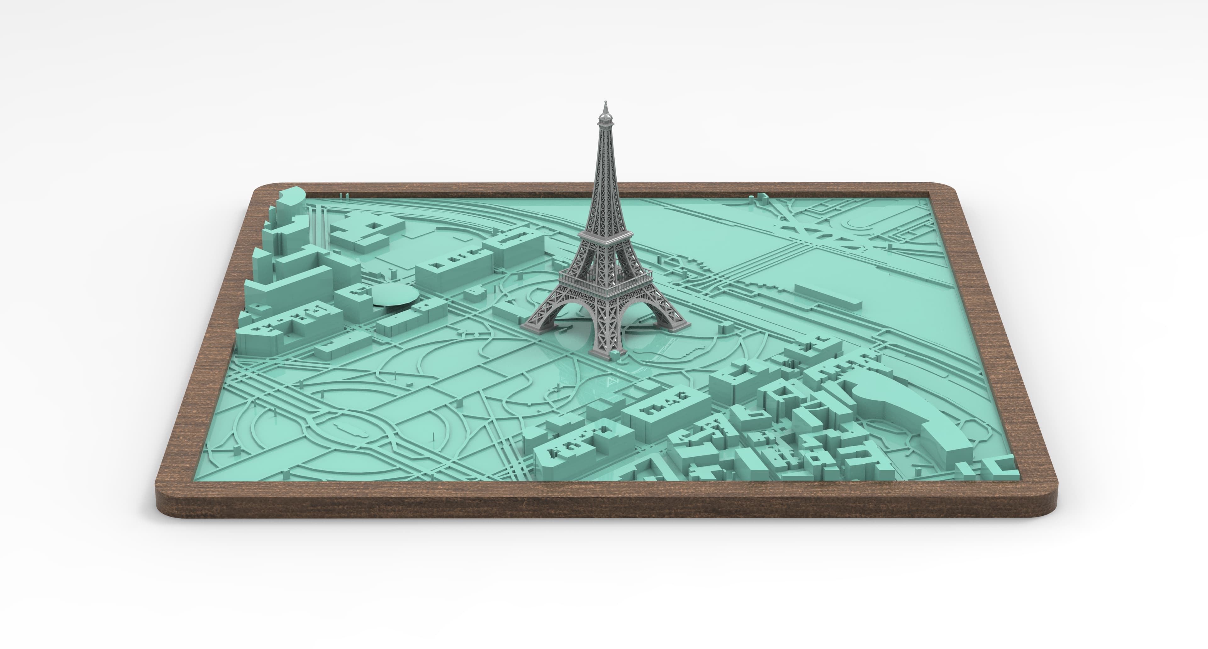
Eiffel Tower 3D City Model | Modèle 3D de la Tour Eiffel avec la ville
.jpg&w=3840&q=75)
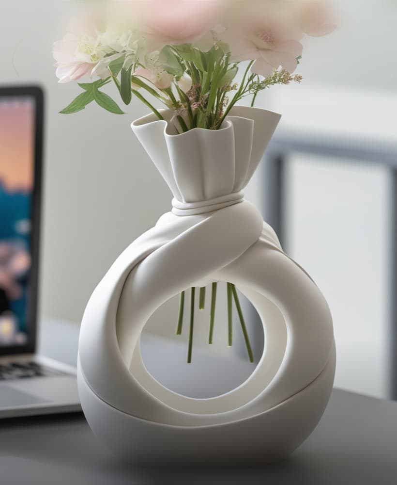
Handbag-Style Decorative Vase | Modern 3D Printable Design
.png&w=3840&q=75)
Bride AND Groom VASE
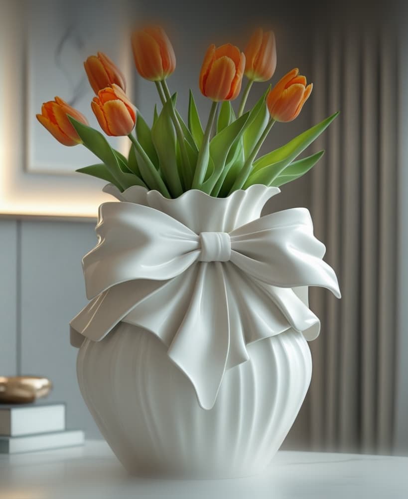
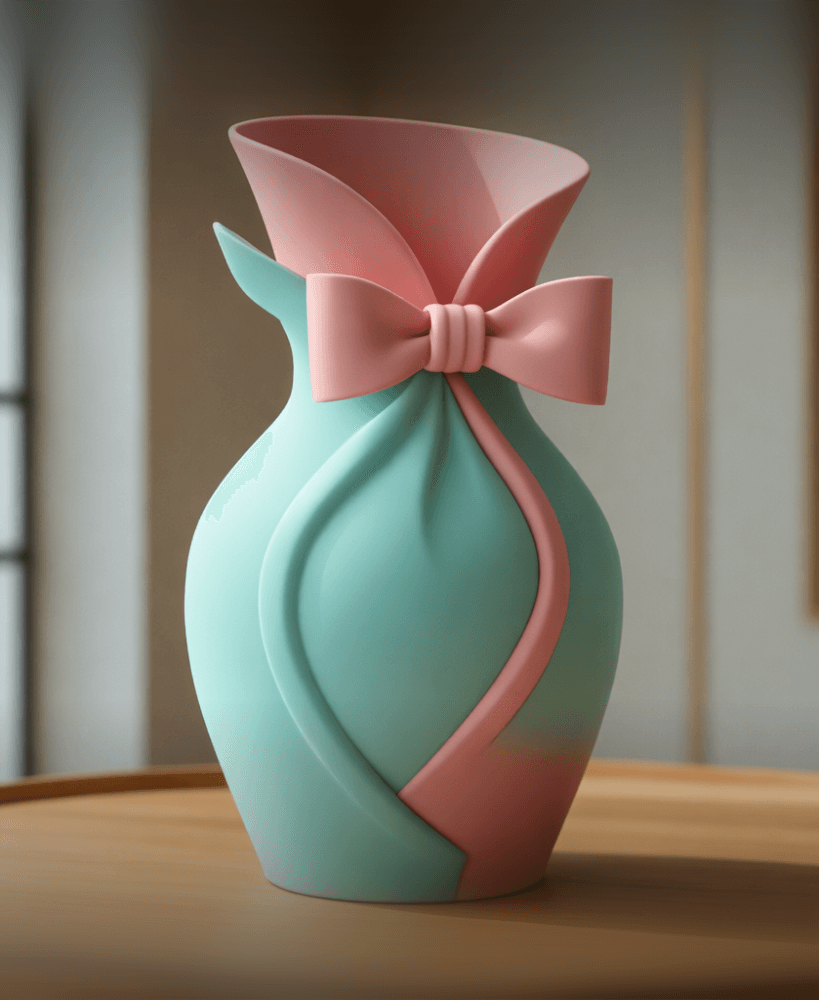
BowForm – 3D Vase Model
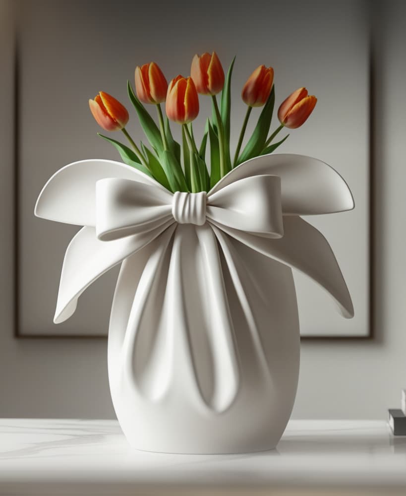
GiftBloom Vase – 3D Model